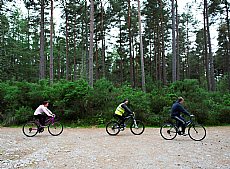
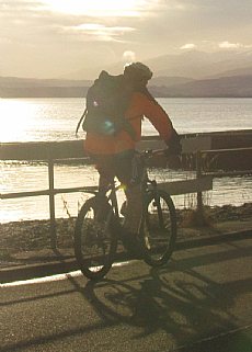
Black Isle & Beauly Firth Cycle Routes
Thirteen cycle routes on the Black Isle are described below. There is also a Beauly Firth loop route with its own downloadable leaflet and map.
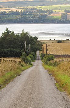
1 - Cromarty - Culbokie
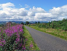
Take the on-road route along the shore for the chance to see wildlife in the Cromarty Firth. Alternatively, take the quieter route along the forest tracks across the spine of the peninsula before enjoying spectacular views from the Eathie Road.
Cromarty to Culbokie
Via Jemimaville and Resolis
All on-road
2 - Cromarty - Rosemarkie
This route takes you up out of Cromarty and along the beautiful Eathie Road, with an optional off-road section that avoids the northerly stretch of the A832. Enjoy fantastic views of the Moray Firth before heading down into Rosemarkie via the Fairy Glen.
Download a printable route card here
Cromarty to Rosemarkie
Via Eathie and the Fairy Glen
Off-road sections (suitable for hybrid bikes) | 50-80 minutes | 9 miles / 15km
 Beginning at the Victoria Hall in Cromarty [1], head east down the High Street, round the right bend and onto Shore Street. Follow this road up the steep hill out of Cromarty past the stables. At the top of the hill [2], turn right and head along the farm track. At the end of this track [3], turn left and head up the hill. Continue on this windy quiet road past Navity, Eathie and the broadcasting mast [4], enjoying the views over the firth. Follow down the other side of the hill down to meet the main road [5]. Turn left down the hill through the Fairy Glen, continue across the bridge and into the village. [6] The car park is on the left after the Plough Inn.
Alternative on-road section
Turn west from Victoria Hall [1] and follow the road up the hill. Turn left signed 'Eathie' [7] and meet the other route [3].
Rosemarkie to Cromarty
Via the Fairy Glen and Eathie
All on-road| 50-80 minutes | 9 miles / 15km
From the car park in Rosemarkie [6], turn right onto the High Street past the Inn and head up the Fairy Glen road. Take the second right signed 'Eathie' [5]. Climb up the hill and glide down the other side. After Navity, go past the farm track on the right [3] and head down the hill. Turn right at the bottom of the hill [7] and follow the road down into Cromarty. You will reach Victoria Hall [1] on the right.
Alternative off-road section (suitable for hybrid bikes)
Take the first right after Navity Cottages [3] on hard core then tarmac road. Take the first left [2] and head down the hill into Cromarty. Follow the road along the shore front and around to the left up onto the High Street. The Victoria Hall [1] is on the left by the playing field.
3 - Rosemarkie - Avoch
Cycle out of Rosemarkie along the shore to avoid the A832, then go from Fortrose to Avoch via the quiet high road or along the old railway line.
Rosemarkie to Avoch
Via Fortrose and Newton
All on-road | 20-30 minutes | 4 miles / 6.6km
 [1] This route starts at the car park by the Plough Inn in Rosemarkie. Turn downhill round the corner and onto 'Marine Terrace'. Continue past the caravan park and the golf course – keeping the clubhouse to your left. At the T junction [2], turn right up hill. [3] Turn left onto 'Deans Road'. By the school [4], turn right onto 'Castle Street'. [5] Cross straight over the High Street at the centre of Fortrose (take care) and go up 'Church Street'. Follow this road up the hill past the turning for Feddon Hill. [6] Take the next left signed 'Insch’. Follow the road all the way through Newton to the T junction [7] and turn left. Head downhill along 'School Brae' to Avoch High Street; the village shop [8] is directly across the street.
Avoch to Rosemarkie
Via the old railway line and Fortrose
Off-road sections (suitable for hybrid bikes) | 20-30 minutes | 4 miles / 6.3km
From the free car park by the village shop in Avoch [8], head up 'School Brae'. [9] Turn right signed 'Braehead'. Bear left into the Parish Church car park and join the old railway line behind. Follow this track all the way along.
 Join 'The Orchard' road [10] and take the first left onto 'Station Crescent' [11]. Follow the road and go straight ahead by the Fire Station. At the T junction [12], turn right and head down the hill to Fortrose High Street [5]. Cross over (take care) and head down 'Castle Street'. Turn left at the next T junction [4] and go down 'Deans Road'. At the T junction with 'Ness Road' [3], turn right down the hill. [2] Take the left turn signed 'Fortrose and Rosemarkie Golf Club'. Follow the road past the golf club and the caravan park. Continue along the shore and round to the left to the free car park [1] in Rosemarkie.
4 - Munlochy - Avoch
This route avoids the busy A832 that connects Avoch and Munlochy, either via an off-road route through Rosehaugh Estate or a quiet on-road route via Killen.
Avoch to Munlochy
Via Killen
All on-road | 35-60 minutes | 7 miles / 11.4km
From the car park by the village shop [1], head up 'School Brae' and continue up the hill and out of the village. Follow the road past the turn to Fortrose [2] and around a sharp left bend over the hills. Turn left at the T junction [3] and continue through Killen and over the bridge. Take the first left at the crossroads [4]. Follow the road down round a dip and past Pink Lodge right to the end. Turn left at the T junction [5] and head downhill to meet the main road [6] (take care). Go right and immediately left down into Munlochy. Follow the main street to the car park on the left [7], just after the post office.
Fortrose connection
From Fortrose, go up Church Street and pass Feddon Hill. Continue to follow the road and when you meet the Avoch route at [2]. turn right to Killen. From Killen, turn left at [2] signed 'Fortrose'.
Munlochy to Avoch
Via Rosehaugh Estate
Off-road sections (suitable for hybrid bikes) | 35-60 minutes | 7 miles / 11.2km
Starting at the free car park in the middle of Munlochy [7], turn right and head up the hill. At the main road [6], turn right (take care crossing) and immediately left up the hill signed 'Culbokie'. Pass Roskill Farm and then take the second right just as the road bends round to the left by Pink Lodge [5]. Follow this road down and round a dip and all the way along to the main road. Turn right at the crossroads [4] and go over the bridge. Take the first right signed 'Burn Farm' [8]. At the bottom of the hill [9] bear right onto the hardcore track and on into Rosehaugh estate.
 Go around the gate by Keepers Cottage, take the road that veers to the right [10] and continue down the hill. Follow the road past the estate offices around the bends and keep going down hill (a sharp right bend [11]) on the tarmac road. Immediately before the bridge over Rosehaugh Burn [12], turn left and follow this track through the farm buildings then all the way to Avoch. Enter the village on Rosehaugh East Drive [13] and follow the road. Turn right at the T junction [14] and continue down School Brae on to the High Street opposite the car park [1].
5 - Munlochy - North Kessock
Avoid the B9161 by cycling along a route via Littleburn and Cotterton that includes off-road sections or through Allangrange on National Cycle Network Route 1.
Munlochy to North Kessock
Via Allangrange / National Cycle Network Route 1
All on tarred surfaces | 25-45 minutes | 6 miles / 9.3km
 Starting at the car park in the centre of Munlochy [1], turn left down the main street past the school. Turn right signed 'Black Isle Brewery' [2] and follow along past Allangrange. At the T junction [3], turn left signed for North Kessock on a blue National Cycle Network route sign. At the next T junction [4], turn right and immediately left signed 'Coldwell' (take care crossing).
Continue through a cluster of houses and down the hill. At the bottom of the hill [5], turn right signed for North Kessock on the blue cycle route sign. This path runs parallel to the A9. Before the road junction, turn left signed for 'North Kessock' [6], go under the A9 and turn left. Cross over the road by the roundabout [7] (take care). Follow the designated cycle path until it runs out then join the road heading down hill. Continue along the road and onto the seafront. The main car park [8] is on the right by the Hotel.
North Kessock to Munlochy
Via Cotterton and Littleburn
Off-road sections (suitable for hybrid bikes) | 30-55 minutes | 6.5 miles / 10.5km
From the North Kessock car park [8], turn left and join the cycle path by Drumsmittal Road. Follow the track over the road and under the A9. Cross over the link road near the roundabout [7] (take care). Continue underneath the A9 and turn right when you meet the roadside cycle path [6]. At the lay-by [5], join the road through the trees and turn left.
 At the T junction [4], turn right and immediately left signed 'Munlochy Animal Aid' (take care crossing road). Continue along this road past the turn for 'Black Isle Brewery' [3]. Turn right signed 'Cotterton' [9]. The surface changes from tarmac, to hardcore then to grass. Continue round to the left, over an old railway bridge then down and round through a farm and onto the tarmac road [10]. At the junction [11], go straight on and follow the road down into Munlochy. Turn left by the school and go onto the main street. The car park [1] is on the right.
6 - Culbokie - Conon Bridge
Cycle along quiet roads by the Cromarty Firth and enjoy outstanding views over to Dingwall and Ben Wyvis, with only brief crossings of the A9 and the A835.
Culbokie to Conon Bridge
Via Alcaig and Corntown
All on-road | 25-40 minutes | 6 miles / 10km
[1] This route starts at the car park for the recreation ground in Culbokie. Turn left and cycle through the village past the primary school. Turn right by the Culbokie Inn [2] and head down the hill. Turn left at the junction [3] then cross the A9 by turning right [4] and immediately left onto the B9163 signed 'Conon Br' (take care).
 Continue along the coast road. Follow the sharp bend around to the right [5] and continue through Alcaig. At the T junction [6], turn right signed 'Conon Bridge'. At the A835 [7], turn right and immediately left into Conon Bridge (take care). Pass the primary school and continue down the hill to the T junction. [8] Turn right down the hill and the central car park is on the left by the church [9].
Conon Bridge to Culbokie
Via Corntown and Alcaig
All on-road | 25-40 minutes | 6 miles / 10km
 For the return journey from Conon Bridge, [9] turn right and up hill out of the car park. [8] Turn left by the War Memorial. [7] Cross the A835 (take care) and then follow the B9163. At Alcaig, turn left signed 'Fortrose' [6]. Follow the road all the way to the A9. Cross the A9 [4] (take care) and take the first right [3]. Turn left at the top of the hill up to Culbokie [2]. Continue through the village to reach the recreation ground car park on the right [1].
There are no reasonable off-road alternatives for this route. However, it is almost entirely on quiet and scenic roads, interrupted only by two crossings of the A9 and A835.
7 - Conon Bridge - Dingwall
Cycle over the River Conon into Maryburgh and along the old road alongside the A862 past Pitglassie into Dingwall.
Conon Bridge to Dingwall
Via Maryburgh and Pitglassie
All on-road | 12-20 minutes | 2 miles / 3.7km
Starting at the car park at the centre of Conon Bridge [1], turn left on the main road. Cycle over the bridge above the River Conon. Continue through Maryburgh past the war memorial. [2] Turn left by the welcome sign onto 'West Way'. Follow round to the right and join the narrower cycle track. Cross the A835 [3] (take care as it is a busy road).
 Follow the cycle track and old road past the Auction Mart. At Pitglassie, join the main road [4] (take care) and follow it into Dingwall. Continue past the traffic lights. Turn right by the blue cycle route sign [5] onto the pavement and down onto Park Street (take care). Turn right at the T junction at the end of this road [6]. The station and car park are on the left as you round the bend [7].
Dingwall to Conon Bridge
Via Pitglassie and Maryburgh
All on-road | 12-20 minutes | 2 miles / 3.7km
Turn left out of the station car park [7] and then left at the traffic lights. Pass the buildings and use the red cycle crossing point (use pavement on both sides) to get to the cycle path on the other side of the road.
At Pitglassie [4], go around the metal gate and join the old road. Cross the mart road (take care) and then join the narrower cycle path. Cross the A835 [3] (take care) and follow the cycle path onto the wider road. Go round to the left and over a bridge. Turn right at the next T junction [2]. Continue through Maryburgh, go over the bridge and up the hill. The large car park is on the right just after the church [1].
There are no reasonable off-road routes to get between Conon Bridge and the cycle path by Maryburgh. However, the main road through the village is relatively quiet.
8 - Culbokie - Munlochy
A quiet and scenic route up over the ridge of the Black Isle, leaving Culbokie through woodland before heading down into Munlochy through farmland.
Culbokie to Munlochy
Via Knockbain
All on-road | 25-40 minutes | 6 miles / 9km
Starting at the car park south of the Culbokie Recreation Ground [1], turn left and cycle through the village. Turn left at the shop [2], head up the hill past Smithfield and continue through the woods. At the T junction at the end of the road [3], turn left up the hill. This road will take you over the hill and round bends towards the other side of the Black Isle.
Pass the turn to Fortrose [4]. Turn right at the T junction next to the electricity substation [5] and continue down the hill. [6] Cross straight over the main road and cycle into Munlochy (take care crossing the road). Follow the road round to the left by Hillpark Brae and carry on down to the main road. The village car park [7] is state ahead across the road.
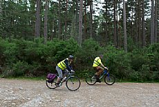
Off-road sections (suitable for hybrid bikes)
Save around 1km and 2 minutes
From the car park [1], take the track on the west side. Follow straight on at the crossroads and continue round a bend to the right. When you meet the road [8], turn left and follow the route from [3].
Munlochy to Culbokie
Via Knockbain
All on-road | 30-45 minutes | 6 miles / 9km
From the car park in Munlochy [7], head up Station Brae. Cross straight over the A832 [6] and cycle up the hill. Turn left just before the electricity substation [5]. Follow this road over the hill and past the turn to Fortrose [4]. [3] Turn right at the unsigned turn with white junction lines as you head down hill. Turn right again at the T junction by the shop [2] and follow through the village. The recreation ground car park [1] is on the right after the school.
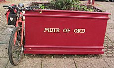
9 - Conon Bridge - Muir of Ord
Avoid the busy A862 between Conon Bridge and Muir of Ord by following National Cycle Network Route 1 and cycling along quiet roads through Bishop Kinkell and Balvaird.
Conon Bridge to Muir of Ord
Via Bishop Kinkell and Balvaird
All on-road | 35-45 minutes | 6 miles / 9km
 This route starts at the free car park near the centre of Conon Bridge [1]. Turn right up the hill and then turn left signed 'Fortrose' [2]. Follow the road past the school and cross over the A835 [3], turning right then left onto the B9163 (take care). Take the first right signed 'Torgorm' [4] and continue along the road.
Turn right at the T junction [5]. Cross back over the A835 [6] by turning right and then immediately left signed 'Muir of Ord' (take care). After a short distance, [7] turn right signed 'Highfield Park'. [8] Turn left by the first house on right, signed 'Rootfield'. Follow the road round sharp bends [9] and turn left signed 'Muir of Ord' [10]. Continue around more sharp bends and turn right at the T junction signed 'Muir of Ord' [11] . Follow through the village and turn left at the T junction [12] onto Seaforth Road. Continue onto the main street [13] and the free car park on the left [14].
Muir of Ord to Conon Bridge
Via Balvaird and Bishop Kinkell
All on-road | 35-45 minutes | 6 miles / 9km
Turn right out of the car park [14] and then turn right onto Seaforth Road [13]. Take the first right onto Balvaird Road [12] and cycle up the hill out of the village. [11] Turn left signed 'Balvaird' and continue around the sharp bends. [10] Turn right at the T junction and follow around more bends [9]. Turn right at the next T junction [8]. Turn left at the T junction [7] and cycle towards the A835.
Cross the A835 by turning right then left signed 'Easter Kinkell' [6] (take care). [5] Take the first left signed 'Torgorm' and follow the road. [4] Turn left at the T junction towards the A835 (not onto the cycle track). [3] Cross back over the A835 by turning right then left into Conon Bridge (take care). Follow the road into the village and then turn right at the T junction [2]. The car park is on the left [1].
10 - Muir of Ord - North Kessock
A beautiful cycle between Redcastle and North Kessock alongside the Beauly Firth, reached by the main road out of Muir of Ord or a route along the old railway line.
Muir of Ord to North Kessock
Via A832 and Redcastle
All on-road | 35-50 minutes | 8.5 miles / 13.7 km
Starting at the car park in the centre of Muir of Ord [1], turn right and then right again at the corner by the Tarradale Hotel [2]. Follow the A832 out of the village (take care around the bends). Turn right at the blue sign for 'Killearnan' and 'North Kessock'.
Continue past Killearnan Parish Church. Turn right at the crossroads [4] and cycle through Redcastle onto the shore road. When you reach North Kessock, turn right at the first T junction [5] and the car park is on the right [6].
North Kessock to Muir of Ord
Via Redcastle and Spittal Wood
Off-road sections (suitable for hybrid bikes) | 45-60 minutes | 8.7 miles / 14.0 km
Turn left out of car park in North Kessock [6] along the shore and turn left past the village hall [5]. Continue out through Charleston and along the shore road. After cycling through Redcastle, turn left at the crossroads [4]. Take the first right up the hill [7] and pass the old school.
Cross over the A832 [8] (take care) and go onto the track on the other side. Continue through a metal gate up the hill and then through another gate. [9] Turn left onto the old railway line (not under the bridge). Follow the track through Spittal Wood, go under another rail bridge and join the tar road. [10] Cross the B9169 and back onto the unpaved old railway line. [11] Turn left onto the tarred track and follow down into Muir of Ord. [12] Turn left at the T junction and follow down the hill. At the next T junction [13], head left onto Seaforth Road. When you reach the main road [14], go straight ahead and the car park is on the left [1].
11 - North Kessock - Inverness
Follow National Cycle Network Route 1 from North Kessock over the Kessock Bridge and down onto Longman Drive, from where you can follow the blue signs into the centre of Inverness.
North Kessock to Inverness
Via National Cycle Network Route 1
All on tarred surfaces | 10-15 minutes | 1.5 miles \ 2.4km
This route starts in the free car park close to the centre of North Kessock [1]. Turn right and cycle along Main Street past the hotel and shop. After the old pier, take the first left signed 'Old Craigton Road' [2]. Continue climbing up, follow the road around a sharp left bent and carry on up to the top on the hill towards the A9.
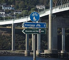 When you reach the segregated cycle track [3], turn right and follow the path all the way over the bridge. On the other side, continue past the steps and take the next right down the hill [4]. This track takes you down to Longman Drive [5]. Follow the blue National Cycle Network signs to the city centre (a further 2.7km / 1.7 miles, 10-15 minutes).
Inverness to North Kessock
Via National Cycle Network Route 1
All on tarred surfaces | 10-15 minutes | 1.5 miles \ 2.4km
 Follow the blue National Cycle Network signs to return to North Kessock. Pass the steps to join the bridge [4]. After reaching the Black Isle, take the first left [3] and continue downhill. Turn right when you reach Main Street [2]. The car park is on the left [1].
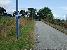
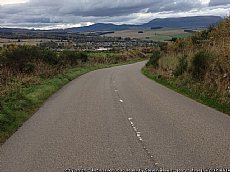
This is an important commuter link for the Black Isle that has the added benefit of fantastic views from the Kessock Bridge. The route follows National Cycle Network Route 1 close to but not on busy roads. See the Inverness Active Travel Map for other route options in the Inverness area.
12 - Avoch - Culbokie
Cycle up from Avoch along quiet back roads to Culbokie, or follow off-road tracks through Rosehaugh Estate and the Old Military Road in the forest.
Avoch to Culbokie
Via Killen and Braefindon
All on-road | 50-75 minutes | 8 miles / 13km
 Starting at the car park next to the village shop [1], head straight over the High Street up School Brae and follow the road. Cycle around a sharp left bend [2] and continue to follow the road over hills. [4] Turn left at the T junction, through Killen and along the road. [5] Turn right at the staggered crossroads and cycle over the hill. After Braefindon, turn left into Culbokie [6] and the recreation ground car park is on the left [7].
Fortrose connection
From Fortrose, head up Church Street and along the road past Feddon Hill. Meet the Avoch route at the junction [3] and turn right to Killen.
From Killen, turn left at [3] signed 'Fortrose'.
Culbokie to Avoch
Via the Old Military Road and Rosehaugh
Off-road sections (suitable for hybrid bikes) | 55-80 minutes | 8.5 miles / 14.0 km
 From the recreation ground car park in Culbokie [7], head south into the woods around the gate. Continue through the woods past the cross roads and over Findon Burn. At the junction [8], turn left and then immediately right onto a narrow
track. [9] Turn right onto the road, cycle round the bend and continue up the hill. Where the road bends to the right [10], head straight onto a hardcore track and continue around a gate into the woods. Follow the narrow track straight ahead up the hill. [11] Join a wider track and continue on. [12] Turn left at the T junction onto the Old Military Road and follow up the hill [13] Cross straight over the road.
[ 14] Turn right down the first good track on the right at the five-way junction. [15] Turn left at the cross roads. Soon after the bridge, [16] turn right signed 'Burn Farm'. [17] Follow the track round to the right onto the hardcore track. Follow round to the left, go around a gate, into the wood and up the hill. [18] Go around the gate and straight on down the hill by Keepers Cottage. Go round a sharp right bend on tar road. [19] Turn left just before the bridge, continue along this track right through to Avoch and follow the road. [20] Turn right onto School Brae, go down the hill and into Avoch [1].
13 - Munlochy - Muir of Ord
Take your bike along part of National Cycle Network Route 1, including the designated path by the A835 and quiet back roads, with optional off-road sections through Littleburn and Spittal Wood.
Munlochy to Muir of Ord
Via Allangrange and Drynie Park
All on tarred surfaces | 45-75 minutes | 10 miles / 16km
From the main car park in Munlochy [1], turn left down the main road. [2] Turn right signed 'Black Isle Brewery' and follow road. [3] Turn right at T junction signed 'Tore'. [4] Turn left at T junction onto A832 in Tore and join the cycle path on the right before the roundabout. [5] Follow cycle path over A9 (take care) and through gap in fence onto Torewood Way. [6] Turn left back onto cycle track by blue National Cycle Network sign to 'Conon Br.'
 [7] Turn left over A835 (take care) signed 'Drynie Park' and continue along the road round sharp bends right to the end. [8] Turn left at T junction onto B9169 and take first right signed 'Ord Muir' (take care). Continue to follow this road around a sharp left bend and down into Muir of Ord. [9] Turn left at the T junction at the bottom of the hill. Go straight ahead at the main road and the car park is on the left [10].
Muir of Ord to Munlochy
Via the Old Railway Line, Spittal Wood and Littleburn
Off-road sections | 50-80 minutes | 9.5 miles / 15.5km
Turn right out of the car park by Muir of Ord Library [10] and then bear right onto Seaforth Road. [9] Take the first right up Balvaird Road. [11] Turn right down Hawthorn Road keeping right past Hawthorn Park. [12] Take the first right onto the Old Railway Line into the woods after the houses. [13] Cross the B9169 (take care) and continue straight over towards Loch na Mhoid. Follow this road straight on where the surface changes and along continue under the bridge.
 [14] Take the first left in the woods signed 'Drynie Park, East and Muir of Ord'. [15] Turn right at T junction at top of the hill. [16] Join the road and turn right. When you reach the A835, cross over to the cycle path (take care) and follow to the right. [6] Turn right where the track meets Torewood Way. [5] Go through the gap in the fence and turn left, cross the A9 (take care) and follow into Tore. [4] Turn right before the garage.
At the crossroads after the houses [17], turn left signed 'Cotterton'. Follow this road continuing where the surface changes to hardcore and then grass. Follow around to the left, over the bridge and around to right. Go straight on and onto the road down into Munlochy. [18] Turn left onto the main road and the car park is on the right [1].
Spittal Wood section only suitable for mountain bikes
The tracks through Spittal Wood [14] - [16] are muddy and only suitable for mountain bikes. If you are on a hybrid bike, consider taking the on-road route to Drynie Park via Balvaird [8].