Black Isle Travel Map
23 March 2015
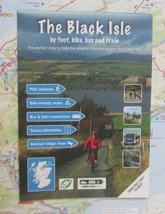 A fantastic green travel map of the Black Isle produced by Helen Stirling for the Million Miles project was delivered to 8,300 Black Isle households in March 2015.
The Black Isle Travel Map is a double-sided A2 folded to A5, featuring:
• Suggested routes for cycling (including designated paths, off-road tracks, quiet roads and main roads)
• Cycle parking and bike shops;
• A summary table and highlighted routes for each of the thirteen Community Cycle Links;
• Information about the outdoor access code;
• Numbered bus routes, bus stops and train stations;
• Signposting to Traveline Scotland, highland.liftshare.com and other Transition Black Isle services (e.g. www.blackislebicycles.co.uk and cycleroutes.transitionblackisle.org);
• Amenities (e.g. schools, cafés, shops) and places of interest (e.g. dolphin watching, viewpoints);
• Nine detailed inset maps covering all of the major settlements on the Black Isle.
Latest News Stories
- 26/04/2024 Abandoned climate target throws Scottish politics into turmoill
- 20/04/2024 Misleading carbon data in 'Six inches of Soil'
- 18/04/2024 18 recommendations from People's Panel on Climate Change
- 08/04/2024 Actions for a Healthy Planet(3) - United Nations
- 04/04/2024 Zero Waste Food Challenge with HCWP
- 25/03/2024 Home Energy in the Highlands - Community Consultation
- 25/03/2024 Recent newsletters received
- 12/03/2024 New season of Gardening Workshops at Allangrange
- 04/03/2024 CAB outreach sessions in Black Isle villages
- 02/03/2024 Magazines offered
Forthcoming Events…
- Saturday 27 April
- 10:00 North Kessock Community market
- Tuesday 30 April
- 19:00 Talk - The Birds and the Bees of Lily Loch
- Wednesday 1 May
- 19:30 TBI Admin (Trustees) meeting 7.30
- Saturday 4 May
- 13:00 Black Isle Repair Cafe at Muir of Ord
- Thursday 9 May
- 18:00 Join in with the Zero Waste Food Challenge: Workshop 2 - Shopping
- Friday 10 May
- 13:00 Uunveiling of the Coronation Tree and Plaque for Ross and Cromarty
- Saturday 11 May
- NA Cromarty Community Market
- Saturday 18 May
- NA BIHS Spring Plant Sale
Events to add to calendar? Contact Us.