New tear-off Black Isle Tourist Map now available
25 March 2015
Black Isle has Tourism All Mapped Out
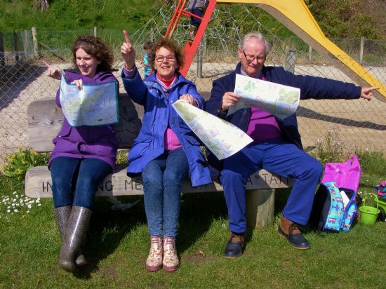
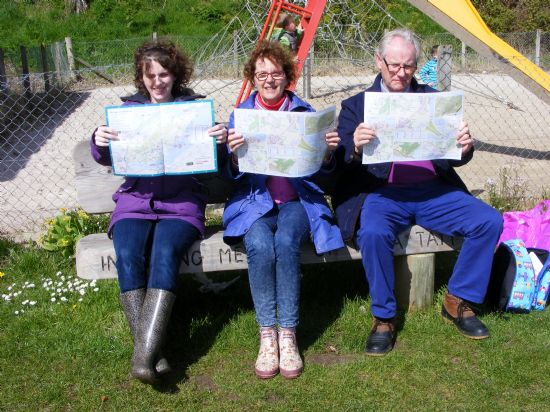 Have you ever had to draw a map on a scrap of paper to help lost tourists? Visitors to the Black Isle will now be able to find their way more easily to all the many attractions of the area, thanks to a new map being launched this week.
The free maps, in tear-off pads, show the peninsula on one side and detailed maps of the local villages on the other, along with key tourist information. Visitors will be able to see at a glance where to find cafes and restaurants, food shops, local food and drink producers, gift shops and galleries, arts, culture and heritage attractions, outdoor activities, and the best spots for cycling and walking, along with all the usual visitor information.
The map is an initiative of the new Black Isle Tourism Team, a loose grouping of people from local businesses and organisations with an interest in tourism, with support from the Black Isle Partnership.
Lizbeth Collie, Destination Development Officer for Black Isle Bicycles and organiser of BITT, explained:
"At our first tourism networking event last November, many people highlighted the need for a visitor map for the Black Isle and we're delighted to be meeting that need in time for the main visitor season. Many thanks are due to Highland Council for their support through the Ward Discretionary Budget, to the Black Isle Partnership and to all those who contributed to the content and design of the maps.
A special thanks is also due to Transition Black Isle's Million Miles Project. Their Active Travel Map, which is proving a real asset to locals, formed the basis of the tourism map and saved us a huge amount of time and money. And award-winning cartographer Helen Stirling has done a great job again."
 Bill Taylor, a tourism consultant based on the Black Isle, added:
"Tear-off giveaway maps are popular with businesses and visitors alike because you can write websites or phone numbers on them, mark routes and destinations, and generally help visitors find what they're looking for more easily.
The map pads will be available for collection through local shops etc and through BITT, and we would encourage everyone who deals with tourists - B&Bs, self-catering businesses, attractions, cafes etc - to get hold of a few for their customers. They're a real asset to the area."
Initially, maps can be collected in Ryefield Farm Shop, Culbokie Spar, The Cheese House in Cromarty, Rosemarkie Beach Cafe, Muir of Ord library, the Black Isle Leisure Centre in Fortrose, the Sports and Model Shop in Dingwall or directly from Lizbeth Collie on lizbeth@blackislebicycles.co.uk . Click here to view a .pdf of the map.
Through the map visitors also have the opportunity to take part in a survey aimed and finding out more about the contribution of tourism to the local economy and about how best to market the Black Isle. The survey can be completed via www.black-isle.info/VisitorMap The black-isle.info website, run by Plexus Media in Cromarty, is a key source of information for visitors and locals alike; businesses and organisations are encouraged to register on the site and make full use of it.
Other Black Isle Tourism Team plans involve setting up a Black Isle Wildlife Trail, Accessible Tourism and creating a "loop" off the new North Coast 500 route as well as working on developing a clearer brand for the area.
Latest News Stories
- 26/04/2024 Abandoned climate target throws Scottish politics into turmoill
- 20/04/2024 Misleading carbon data in 'Six inches of Soil'
- 18/04/2024 18 recommendations from People's Panel on Climate Change
- 08/04/2024 Actions for a Healthy Planet(3) - United Nations
- 04/04/2024 Zero Waste Food Challenge with HCWP
- 25/03/2024 Home Energy in the Highlands - Community Consultation
- 25/03/2024 Recent newsletters received
- 12/03/2024 New season of Gardening Workshops at Allangrange
- 04/03/2024 CAB outreach sessions in Black Isle villages
- 02/03/2024 Magazines offered
Forthcoming Events…
- Saturday 27 April
- 10:00 North Kessock Community market
- Tuesday 30 April
- 19:00 Talk - The Birds and the Bees of Lily Loch
- Wednesday 1 May
- 19:30 TBI Admin (Trustees) meeting 7.30
- Saturday 4 May
- 13:00 Black Isle Repair Cafe at Muir of Ord
- Thursday 9 May
- 18:00 Join in with the Zero Waste Food Challenge: Workshop 2 - Shopping
- Friday 10 May
- 13:00 Uunveiling of the Coronation Tree and Plaque for Ross and Cromarty
- Saturday 11 May
- NA Cromarty Community Market
- Saturday 18 May
- NA BIHS Spring Plant Sale
Events to add to calendar? Contact Us.