New Black Isle Visitor Map
14 March 2023
Launch of new map and Slow Tourism booklet
The new Black Isle map was formally launched at a low-key event at Fortrose and Rosemarkie Golf Club organised by the resurgent Black Isle Tourism group, in conjunction with a new 'Slow Tourism' booklet prepared by the group and featuring three articles by TBI Convenor Julian Paren. Funding for the event was contributed by Highlands and Islands Climate Hub, and it was capably led by Becky Richmond, Chair of the Black Isle Tourism Team.
The new map (see below) will be available free of charge at a range of outlets throughout the Black Isle, thanks to funding for the Tourism Group from Highland Council. It replaces the previous TBI Active Travel Map and the tear-off A3 Tourist Map, though a few of these may still be available.
On behalf of Black Isle Tourism, Jon Palmer made a presentation of cheese from his Cromarty shop to Helen Stirling, the cartographer who has done wonderful work in preparing all the editions of both maps; and Becky paid tribute to Julian Paren for his work over many years both in developing and updating the content of the maps, and in conjunction with Helen, overseeing their production.
The Slow Tourism booklet is intended to be made available for visitors to read by accommodation providers, who will also hold stocks of the map to give to their guests. In addition to articles by Julian on the new map and on Woodlands and Footpaths of the Black Isle, the booklet includes an article by Jon Palmer promoting the Black Isle brand 'Savour the Unexpected', and an article on the ecology of the Black Isle by Ro Scott.
In her role as Project Manager for the Black Isle Local Place Plan, Becky introduced Nick Wright, an experienced planner who has been engaged to oversee the process of consultation and discussion which will lead to the preparation of a Local Place Plan for the Black Isle, which will then feed into the already well advanced deliberations on the new Inner Moray Firth Local Development Plan. Drop-in consultations on the Place Plan are currently taking place in all the Black Isle villages.
See this page for information on the Place Plan.
-------------------------
January 2023
A Black Isle Map for 2023 Julian Paren
 Whether you look at maps of the Black Isle on your mobile phone or paper maps from Ordnance Survey there is a limit to the amount of detail shown at whatever scale you examine them. If your life revolves around your car and the main roads any map may satisfy you, but if you want to get to know what the Black Isle offers for leisure activities and amenities you need to look elsewhere.
In March 2015 Transition Black Isle produced the first Active Travel Map of the Black Isle which has had three editions. Later in 2015 the same cartographer, Helen Stirling, produced for Black Isle Tourism a map at half the scale, specifically for visitors, and this has been updated over the years. The Visitor Maps have been part-funded through grants to Black Isle Tourism from Highland Council.
During 2022 it became clear that both these existing maps needed new editions, so the decision was made to combine their information into a single folding full-scale map. So was conceived The Black Isle - a map for locals and visitors exploring by foot, bike, bus and car. Fifteen thousand maps have been printed and will be available across the Black Isle. So, you may well ask, what does the map show that is unavailable on other maps?
 One side of the map has detailed village plans of ten Black Isle villages with road names and keys to Amenities and Visitor Attractions. There are QR codes to access more travel tips on Walking, Cycling, Public Transport and Lift Sharing. There are succinct descriptions on what the Black Isle is renowned for with its firths, forests, farmland and favoured climate.
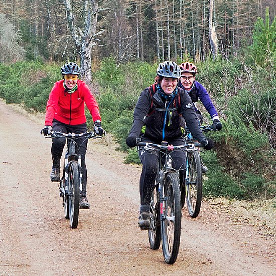
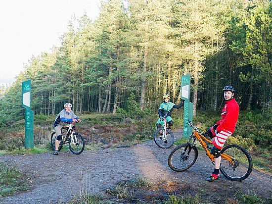
The other side is dominated by the map of the Black Isle and hinterland at a scale of 1:65,000. The emphasis on leisure activities is clear. There are 13 recommended safe cycle routes for road bikes and 9 cycle routes with off-road sections suitable for hybrid bikes. Bike shops, bike parking and bike hire facilities are shown. The map gives links to the Transition Black Isle website where each route is described in detail and for which route cards can be downloaded.
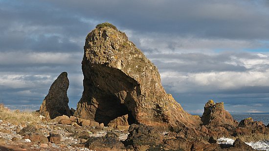
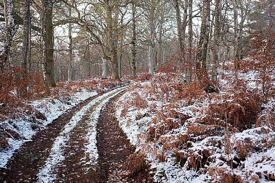
 The map shows hundreds of miles of footpaths which have been walked and tested in recent years. These can form the basis for further exploration as long as the Countryside Access Code is followed. The footpaths are a way-in to the great diversity The Black Isle offers. You can explore Oak Woods, Beech Woods, Silver Birch Woods and Bog Forest in addition to the plantations of Forest and Land Scotland. Then there are the Country Estates with fine houses (a number demolished) with walks through parkland, policies and woodland. The coastline too has paths and walking routes, with some that are identified as being impassable at certain tide levels.
For many, The Black Isle is an enjoyable diversion from the North Coast 500, but two other major routes also cross the Black Isle, and both are marked. The John o’ Groats Trail is a walking trail that leaves Inverness by the Kessock Bridge and heads to Munlochy and Culbokie, while the Far North Way (previously known as National Cycle Route 1) crosses the Black Isle by two routes. The more interesting of these is the preferred summer route which goes to Cromarty and uses the Cromarty to Nigg ferry.
Black Isle Tourism and Transition Black Isle trust the map will help all to fully explore what our beautiful area has to offer. It is their hope that by using the map you can feel more confident incorporating cycling, walking and public transport into your activities for a healthier and more sustainable future.
Julian Paren January 2023
You can preview the main map and village plans as .PDF files, and zoom in and move around to see the details.
The map is available across the Black Isle free of charge
(A free tear-off tourist map may also still be available from outlets on the Black Isle)
How you can help to keep the map up-to-date
A number of the off-road cycle routes and footpaths on the Black Isle have been visited by TBI members in order to ensure the accuracy of the information on the map at the time of this printing. However conditions do change. Could all users of the map please e-mail info@transitionblackisle.org should they find routes and paths that are no longer viable.
Map Update Information
Feedback from users on the state of paths and tracks or access issues, or the discovery of useful paths “missing” from the map will be posted in this section. This will be valuable when the time comes to prepare a Fourth Edition in due course.
Now go and explore!
Julian Paren.
Latest News...
 Black Isle Gathering 2024 Saturday 19 October Fortrose Leisure Centre
Saturday 19 October 10.00 - 4.00 Fortrose Leisure Centre
Apple pressing with TBI
Transition ... More >>
Black Isle Gathering 2024 Saturday 19 October Fortrose Leisure Centre
Saturday 19 October 10.00 - 4.00 Fortrose Leisure Centre
Apple pressing with TBI
Transition ... More >>Forthcoming Events…
- Tuesday 22 October
- 18:00 Zero Food Waste Challenge - Fermenting & Pickling Workshop
- Saturday 26 October
- 16:00 Halloween on the Green at Culbokie
- 10:00 North Kessock Community market
- Tuesday 29 October
- 18:00 Zero Food Waste Challenge - Cooking With Leftovers
- Friday 1 November
- 19:00 Hallowe'en stories and songs at Bunloit
- Tuesday 5 November
- 18:00 Zero Food Waste Challenge - Composting Workshop
- Saturday 9 November
- NA Cromarty Community Market
- Saturday 16 November
- NA Culbokie Community Market
Events to add to calendar? Contact Us.


TBI Business Directory
Add Your Business
Do you run a sustainable business on or near the Black Isle? Add it to the TBI business directory
Browse Directory
- Accommodation (3)
- Crafts (9)
- Health and fitness (8)
- Home improvements (17)
- Local food suppliers (18)
- Miscellaneous (35)
- Renewable energy (18)